 Fagradalsfjall Volcano Trips
Is Fagradalsfjall Safe? A Plain Guide to Volcano Safety
Is Fagradalsfjall safe? Yes, for most people, as long as you respect four real hazards. Nothing has erupted at Fagradalsfjall itself since early August 2023, and every tour now walks cooled lava from the 2021 to 2023 eruptions on a marked trail network about 40 km (25 mi) from Reykjavík. The Icelandic Met Office keeps monitoring the area and names a new intrusion or eruption on the nearby Sundhnúkur crater row as the likely next step, but nobody can give a date. This page covers each risk in turn: the lava rule, volcanic gas and who should stay away, weather and wind, sinkholes, what happens if a new eruption starts, emergency numbers, and when a guide makes a real difference. To weigh the guided options, see Fagradalsfjall tours with their time on the lava.
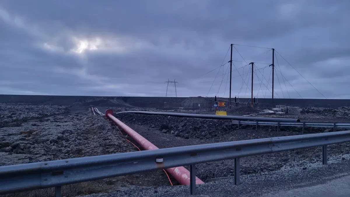
Svartsengi's pipelines now run behind earthen barriers built to protect the plant from the Sundhnúkur eruptions. Photo: Gaggi96, CC0, via Wikimedia Commons
Quick answer The short answer
Yes, Fagradalsfjall is safe for most visitors when the trails are open. No eruption is active there, the most recent eruption at Fagradalsfjall ended 5 August 2023, and every tour walks cooled lava on marked paths. The real hazards are thin lava crust, invisible volcanic gas, sinkholes and fast-changing weather.
Key takeaways
- Never step on the lava, even the cooled black crust, because hot rock can sit under a thin shell. Read the gas and lava rules below.
- Children under 12, pregnant travelers and people with heart or lung disease should stay away when gas pollution is present. The hike with a geologist applies the same rule year round.
- If a new eruption starts, sirens sound and trails close at short notice. Check what a closure means for your booking on the weather cancellations page.
- Compare short and long Fagradalsfjall hikes compared and read what you will actually see before deciding.
The Honest Starting Point: Nothing Is Erupting at Fagradalsfjall
Safety questions about Fagradalsfjall start with the current status, because an active eruption and a cooled lava field are two different places.
What the Icelandic Met Office says
The Met Office's latest situation update states that no eruption is active. The last (ninth) eruption in the Sundhnúkur series, near Grindavík and northeast of Fagradalsfjall, ended in early August 2025. Since 2021 the peninsula has seen 12 identified eruptions in total: three at Fagradalsfjall itself (2021, 2022 and 2023) and nine on the Sundhnúkur crater row between December 2023 and August 2025.
The ground under Svartsengi is rising again. About 29.1 million cubic metres of magma have accumulated since the most recent eruption, with an uncertainty range of 28.3 to 29.9 million cubic metres, and the land rose by roughly five centimetres over the past three months at the SKSH GPS station. As long as uplift continues, the Met Office names a magma intrusion into the Sundhnúkur crater row as the most likely next step. It states plainly that nobody can predict when such an event might occur and that a short lead time must still be expected. Seismicity remains low, with a slight recent increase in small earthquakes.
For your safety planning this means two things. First, the Fagradalsfjall trail network over the 2021 to 2023 lava is permitted for hiking when no eruption is active, which it currently is. Second, the Sundhnúksgígar eruption site nearer Grindavík is closed, with no hiking trails or parking areas defined there. Any tour listing that promises flowing lava is describing the past, not the present.
One warning about stale listing text
Some operator listings still carry old copy. At least one tour description elsewhere on the market still advertises erupting lava at Litli-Hrútur, a flow that stopped on 5 August 2023, and one bus tour's text calls the site a live volcanic eruption. Visit Reykjanes's own FAQ even carries a leftover sentence saying an eruption is ongoing, contradicting its own news feed.
Treat the Icelandic Met Office as the authoritative source on status and treat any listing that promises lava as marketing written years ago. Before booking, compare the hikes, loops and flights and read each description against the Met Office status.
Gas and the Lava Rule
Two hazards cause most of the real danger on this hike, and neither looks dangerous from a distance.
The rule that keeps people alive: never walk on the lava
Do not walk on the lava under any circumstances. Safetravel.is, the official Icelandic safety portal, states that the crust might seem sturdy but can be thin with hot lava underneath. This rule stays in force even after an eruption ends, because the rock may still be fresh underneath. The 2021 eruption alone produced 151 million cubic metres of lava covering 4.8 square kilometers.
The marked paths go beside the flows, never across them. Stay on them at all times, which also protects the moss and the terrain around the flows.
Volcanic gas: invisible, odourless and fast
Sulphur dioxide pollution from volcanic areas is odourless and not visible, and it can collect quickly at the site. This is the hazard people most often misjudge, because gas you cannot see or smell can collect quickly at the site even on a clear day. Check the live forecast at loftgaedi.is, the Environment Agency of Iceland air quality map, before you head out and again along the trail.
The official guidance on who should avoid the area is explicit. Children younger than 12 are not recommended at the eruption site if there is gas pollution. Pregnant women and people with heart or lung disease are recommended not to go, because of possible gas pollution and smoke from wildfires. Some operators apply the under-12 rule permanently rather than only on polluted days. The geologist-led hike, for example, excludes children under 12, pregnant travelers and people with respiratory issues outright.
Who is excluded, rule by rule
The table below collects the official gas guidance and how it shows up in real listings, so you can see who the advice affects and how operators turn it into booking rules. The guidance comes from Safetravel.is and the tour rules come from the operator listings compared on the homepage.
| Who | Official advice | How listings handle it |
|---|---|---|
| Children under 12 | Not recommended at the eruption site when gas pollution is present | The geologist hike and several bus tours simply bar under-12s at all times |
| Pregnant travelers | Recommended not to go because of possible gas pollution and wildfire smoke | Several tours list pregnancy as a blanket exclusion |
| Heart or lung conditions | Recommended not to go, same reason | The geologist hike excludes people with respiratory issues, bus tours warn against poor cardiovascular health |
| Everyone else | Check the loftgaedi.is forecast before and during the hike | No listing rule, the check is yours |
Ground hazards: sinkholes and crevasses
Subsidence and sinkholes have been observed on the Reykjanes peninsula, including near features like the Bridge Between Continents area, and Safetravel.is advises staying on marked paths and roads because of crevasse risk. On the trails themselves, the Meradalir route (path E) is the one where the warning is spelled out: about 18 to 20 km both ways, 5 to 6 hours of hiking, challenging, with crevasses expected so you should stay on paths. The principle holds on every route: keep to the marked line.
Is Fagradalsfjall Safe on Video
A geologist explains the Svartsengi uplift and what the next eruption may look like. Third-party video by GeologyHub. We did not shoot it and have no relationship with the creator.
Weather, Wind and the Trails
The second-biggest safety factor on any given day is not volcanic at all. It is the weather on a treeless peninsula at 385 m (1,263 ft).
Why wind and cold matter more than the volcano
Fagradalsfjall is a tuya, a table mountain rising to 385 m (1,263 ft), and the trails approach it over open ground with no shelter, no trees and no buildings. Weather can turn faster than the forecast, and Safetravel.is points visitors to en.vedur.is, the Icelandic Meteorological Office, for current conditions. The Keflavík Airport climate normals give an average daily maximum of 11.1C in September and 3.4C in the depth of winter, with annual precipitation of about 1,377 mm, which tells you the baseline: cool, wet and exposed most of the year.
Daylight is a winter constraint too: Reykjavík daylight averages about 13 hours 3 minutes a day in September but drops steeply toward the solstice, so a late start in the dark months compresses your margin for error. Pack layers, a waterproof and proper boots, and turn back early if the sky darkens. Our what to bring page covers the full kit by season.
Trail difficulty, honestly stated
Not every route here deserves the word moderate. The paths from the P1 and P2 car parks vary a lot, and picking one that matches your fitness is itself a safety decision. Distances and times below come from Visit Reykjanes's official hiking page.
Operators rate the same ground differently too: the geologist-led tour calls its route difficult through rough terrain and requires hiking experience, while a minibus sightseeing loop only touches the area with a short viewpoint walk.
| Path | Distance one way | Time | Difficulty and hazards |
|---|---|---|---|
| Path A, Mt. Fagradalsfjall (pink) | About 6-8 km | About 2-2.5 hours | Moderate to challenging, passes the 2021, 2022 and 2023 eruption sites |
| Path B, Mt. Fagradalsfjall (dark blue) | 4.7 km to first viewing site, 6.1 km to the second | Not stated | Challenging terrain toward the Sundhnúksgígar direction |
| Path C, Mt. Langihryggur (green) | About 4 km | Not stated | Views of all three Fagradalsfjall eruptions but not the crater itself |
| Path E, Meradalir | About 18-20 km both ways | 5-6 hours total | Challenging, crevasses expected, stay on paths |
| Nátthagi paths (yellow) | About 2 km | Shortest option | Much shorter and easier than the other routes |
Facilities, or the lack of them
There are no cafés, shops or staffed kiosks at the trailheads. Portable toilets are sometimes set up at the main P1 and P2 parking areas, though sources conflict on how reliably they are present, so treat them as a bonus rather than a plan. Bring your own water and food, a charged phone and warm spares.
Parking at the volcano costs 1,000 ISK (about $8), paid electronically through the Parka app or at parka.is, with a paid ticket valid for 24 hours. None of that affects your physical safety directly, but arriving with no food, no water and a nearly dead phone turns a weather delay into a real problem on an exposed mountain.
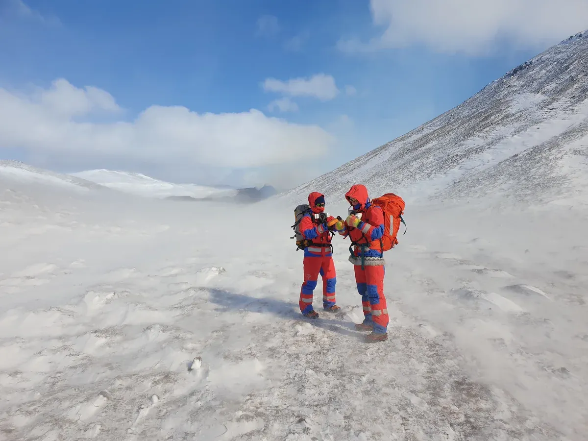
The same gravel path that rescue teams used in 2021 is still the main hiking route across the lava field today. Photo: Steinninn, CC BY 4.0, via Wikimedia Commons
If a New Eruption Starts
The Met Office says a short lead time must still be expected for the next eruption on the peninsula. Here is what that means on the ground.
Sirens, closures and quick decisions
Evacuation sirens will sound if the threat level rises, and Safetravel.is advises visitors to know their exit route before setting out. A new intrusion can close trails, roads and Grindavík at short notice. It can also happen while you are on the trail, which is why the exit-route advice matters: you should know which way the car park lies and which path you came in on before you start hiking, not after your phone buzzes.
Recent eruptions here varied widely in length. The eighth Sundhnúkur eruption on 1 April 2025 lasted about 7 hours. The ninth ran 16 July to 5 August 2025, about 20 days. An eruption can start, close the area and end before some visitors have even flown in. The flip side is that Icelandic authorities monitor this system closely with GPS, seismic and gas instruments, and closures go into effect fast. Your job is to respect the closure, not to test its edges.
Where to check before you go
Four sources cover it. En.vedur.is carries the Icelandic Meteorological Office's status updates and the weather. Loftgaedi.is carries the live gas pollution map.
Road.is and umferdin.is carry road closures, and safetravel.is carries the volcanic hazard picture in one place. Check all of them the morning you go, not the night before, because conditions change with volcanic activity. Grindavík itself is open to visitors and can be explored, though caution is advised, and route access should be re-checked before travel.
Several tours in the comparison visit the town as a stop, including the Reykjanes volcanoes, Grindavík and hot springs tour, whose own listing text is unusually honest that no lava is currently flowing and that an eruption could resume at any time.
Sources: Safetravel.is, Icelandic Met Office
Emergency Numbers, the 112 Iceland App and Why a Guide Helps
If something goes wrong, help exists and reaches this area. The preparation is on you.
The numbers and the app
Dial 112 for emergencies in Iceland. If a call to 112 has poor audio quality, gets disconnected, or 2G/3G connectivity is an issue, use the backup number 599-0112. Beyond calling, install the 112 Iceland app before you hike. It is a free safety app published by ICE-SAR, the Icelandic rescue service, that lets a hiker send a text-style report plus GPS location straight to the emergency operator without a phone call. Conventional mobile signal is enough and no data connection is required. It is available on safetravel.is, the App Store and Google Play.
Two practical notes. First, the app needs only a conventional mobile signal, so a text report can get through where a voice call struggles. Second, tell someone your route and when you expect to be back.
What a guide actually does on a bad day
A guide earns the fee in three specific situations. On gas and weather: the call on whether the hike runs sits with the operator, and every listing in the catalog offers free cancellation up to 24 hours before departure. On gear: the small-group local hike supplies hiking poles and crampons in winter, and the geologist hike supplies a headlamp and crampons if needed. On route choice: the difference between a 2 km Nátthagi walk and an 18-20 km Meradalir loop is the difference between a short outing and a day where crevasses and exhaustion become real factors.
The small-group formats put those decisions closest to you. The geologist-led crater hike runs with a maximum of 6 participants over rough terrain, and the original local small-group hike caps pickup groups at 7 on a moderate route of about 8 km round trip with roughly 300 m of elevation gain. On a clear calm day you can do this hike safely alone, and our without a tour page explains exactly how. On a day with gas readings, rising wind or a fresh closure, being with a guide is the safer bet.
Sources: 112.is, Safetravel.is
Safety Dos and Don'ts at Fagradalsfjall
The whole page in one list, for the trailhead.
Do
- Do check loftgaedi.is for gas, en.vedur.is for weather and road.is for closures on the morning of your hike, because conditions change with volcanic activity.
- Do install the free 112 Iceland app before setting out, because it sends your GPS location to the emergency operator by text with only a mobile signal.
- Do stay on the marked paths at all times, because Safetravel.is advises it for crevasse and sinkhole risk.
- Do know your exit route before you start, because evacuation sirens sound if the threat level rises and lead time can be short.
- Do bring water, food and warm layers, because there are no shops or staffed facilities at the trailheads.
Don't
- Don't walk on the lava, even cooled crust, because the shell can be thin over hot rock and the rule stays in force years after an eruption ends.
- Don't bring children under 12, and don't go yourself if pregnant or if you have heart or lung disease, when gas pollution is present, because the pollution is odourless and invisible.
- Don't attempt path E to Meradalir casually, because it runs 18-20 km both ways with crevasses expected.
- Don't treat a tour listing promising flowing lava as current information, because the most recent eruption at Fagradalsfjall ended on 5 August 2023 and some copy was never updated.
- Don't start late in the dark months, because Reykjavík daylight drops well below the roughly 13 hours available in September and a delayed return becomes a night rescue risk.
Safety Questions About Fagradalsfjall
Is Fagradalsfjall dangerous right now?
No eruption is active. The Icelandic Met Office's latest update confirms no eruption, with the most recent one on the peninsula ending in early August 2025, though magma keeps accumulating under Svartsengi and the next event cannot be predicted. The what you will see page covers the current status in detail.
Can you still see lava at Fagradalsfjall?
No flowing lava. You see the cooled black fields from the 2021, 2022 and 2023 eruptions, and the Sundhnúksgígar site nearer Grindavík is closed to hiking. Walking on the cooled lava is strictly forbidden because the crust may still be thin and hot underneath. The sightseeing loop through Grindavík and the lava fields is one honest way to see the youngest rock without a long hike.
How many people died in the Iceland volcano eruptions?
Not stated in our sources. None of the official safety guidance from Safetravel.is, the Icelandic Met Office or Visit Reykjanes records any visitor deaths in the Fagradalsfjall or Sundhnúkur eruptions, but we cannot give you a confirmed figure either way. The safety rules on this page exist because the main risks, gas and thin crust, are invisible rather than dramatic.
Is Fagradalsfjall safe to hike alone without a guide?
It can be, when the trails are open and the weather and gas readings are clean, and no guide is required. The trade-off is that you make the go or no-go calls yourself, and some operators rate this terrain as difficult. The without a tour guide lays out the self-guided version step by step.
Is Fagradalsfjall safe for kids?
Children younger than 12 are not recommended at the eruption site if there is gas pollution, per official guidance, and several tours bar under-12s entirely. The shortest and easiest route is the Nátthagi path at about 2 km one way. The with kids page covers ages, carrying small children and the low-walking options.
Can I hike Fagradalsfjall while pregnant?
Pregnant women are recommended not to go because of possible gas pollution and smoke from wildfires, per Safetravel.is. Several operators list pregnancy as a blanket exclusion on their hikes and bus tours. If you still want to see the Reykjanes lava fields, the helicopter flight over the eruption sites involves no hiking.
What happens to my tour if a new eruption starts?
Trails, roads and sometimes Grindavík close at short notice, with sirens sounding if the threat level rises, and operators or the authorities then cancel trips in the affected area. What you get back depends on each listing's cancellation terms, all of which offer free cancellation up to 24 hours before departure. The weather cancellations page compares the terms tour by tour.